
Thank you for supporting this site ❤️
Make a donation
Make a donation
Vila Chã topographic map
Click on the map to display elevation.
Thank you for supporting this site ❤️
Make a donation
Make a donation
About this map
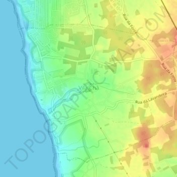
Name: Vila Chã topographic map, elevation, terrain.
Location: Vila Chã, Vila do Conde, Porto, Portugal (41.28515 -8.73952 41.30764 -8.70628)
Average elevation: 22 m
Minimum elevation: 0 m
Maximum elevation: 54 m
Thank you for supporting this site ❤️
Make a donation
Make a donation
Other topographic maps
Click on a map to view its topography, its elevation and its terrain.