
Thank you for supporting this site ❤️
Make a donation
Make a donation
Willbriggie topographic map
Click on the map to display elevation.
Thank you for supporting this site ❤️
Make a donation
Make a donation
About this map
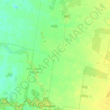
Name: Willbriggie topographic map, elevation, terrain.
Average elevation: 125 m
Minimum elevation: 118 m
Maximum elevation: 134 m
Thank you for supporting this site ❤️
Make a donation
Make a donation
Other topographic maps
Click on a map to view its topography, its elevation and its terrain.
Sir Dudley de Chair Lookout
Australia > New South Wales > Griffith City Council > Griffith
Average elevation: 148 m
Borland Leckie Park
Australia > New South Wales > Griffith City Council > Griffith
Average elevation: 126 m