
Thank you for supporting this site ❤️
Make a donation
Make a donation
Tetela Del Monte topographic map
Click on the map to display elevation.
Thank you for supporting this site ❤️
Make a donation
Make a donation
About this map
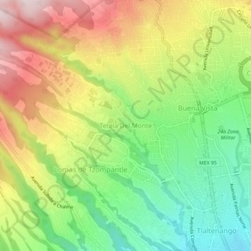
Name: Tetela Del Monte topographic map, elevation, terrain.
Location: Tetela Del Monte, Cuernavaca, Morelos, 62130, Mexico (18.94323 -99.27961 18.98323 -99.23961)
Average elevation: 1,821 m
Minimum elevation: 1,614 m
Maximum elevation: 2,077 m
Thank you for supporting this site ❤️
Make a donation
Make a donation