
Thank you for supporting this site ❤️
Make a donation
Make a donation
Felchow topographic map
Click on the map to display elevation.
Thank you for supporting this site ❤️
Make a donation
Make a donation
About this map
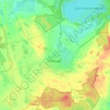
Name: Felchow topographic map, elevation, terrain.
Location: Felchow, Schwedt/Oder, Uckermark, Brandenburg, Deutschland (53.01635 14.07511 53.05589 14.14879)
Average elevation: 56 m
Minimum elevation: 33 m
Maximum elevation: 84 m
Thank you for supporting this site ❤️
Make a donation
Make a donation
Other topographic maps
Click on a map to view its topography, its elevation and its terrain.