
Thank you for supporting this site ❤️
Make a donation
Make a donation
Bim topographic map
Click on the map to display elevation.
Thank you for supporting this site ❤️
Make a donation
Make a donation
About this map
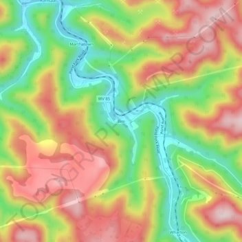
Name: Bim topographic map, elevation, terrain.
Location: Bim, Boone County, West Virginia, 25021, United States (37.90177 -81.70928 37.94177 -81.66928)
Average elevation: 446 m
Minimum elevation: 263 m
Maximum elevation: 624 m
Thank you for supporting this site ❤️
Make a donation
Make a donation
Other topographic maps
Click on a map to view its topography, its elevation and its terrain.