
Thank you for supporting this site ❤️
Make a donation
Make a donation
Belding topographic map
Click on the map to display elevation.
Thank you for supporting this site ❤️
Make a donation
Make a donation
About this map
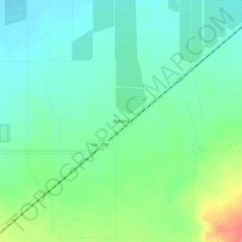
Name: Belding topographic map, elevation, terrain.
Location: Belding, Pecos County, Texas, United States (30.77127 -103.04516 30.81127 -103.00516)
Average elevation: 980 m
Minimum elevation: 960 m
Maximum elevation: 1,029 m
Thank you for supporting this site ❤️
Make a donation
Make a donation
Other topographic maps
Click on a map to view its topography, its elevation and its terrain.