
Thank you for supporting this site ❤️
Make a donation
Make a donation
Jerusalem topographic map
Click on the map to display elevation.
Thank you for supporting this site ❤️
Make a donation
Make a donation
About this map
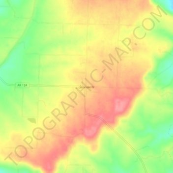
Name: Jerusalem topographic map, elevation, terrain.
Location: Jerusalem, Conway County, Arkansas, 72080, United States (35.38480 -92.83683 35.42480 -92.79683)
Average elevation: 221 m
Minimum elevation: 170 m
Maximum elevation: 258 m
Thank you for supporting this site ❤️
Make a donation
Make a donation
Other topographic maps
Click on a map to view its topography, its elevation and its terrain.