
Lorsbach topographic map
Click on the map to display elevation.
About this map
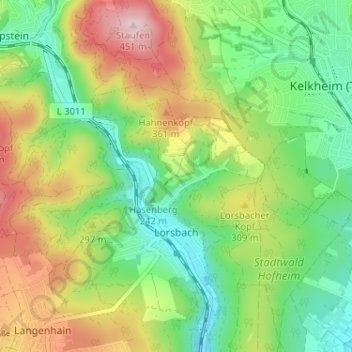
Name: Lorsbach topographic map, elevation, terrain.
Location: Lorsbach, Hofheim am Taunus, Main-Taunus-Kreis, Hesse, Germany (50.10495 8.37490 50.14243 8.43919)
Average elevation: 261 m
Minimum elevation: 147 m
Maximum elevation: 440 m