
Thank you for supporting this site ❤️
Make a donation
Make a donation
Kalmar kommun topographic map
Click on the map to display elevation.
Thank you for supporting this site ❤️
Make a donation
Make a donation
About this map
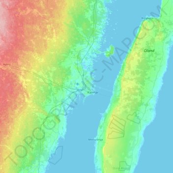
Name: Kalmar kommun topographic map, elevation, terrain.
Location: Kalmar kommun, Kalmar County, Sweden (56.42557 15.74136 56.93168 16.55630)
Average elevation: 28 m
Minimum elevation: -2 m
Maximum elevation: 131 m
Thank you for supporting this site ❤️
Make a donation
Make a donation
Other topographic maps
Click on a map to view its topography, its elevation and its terrain.