
Thank you for supporting this site ❤️
Make a donation
Make a donation
Mount Finlayson topographic map
Click on the map to display elevation.
Thank you for supporting this site ❤️
Make a donation
Make a donation
About this map
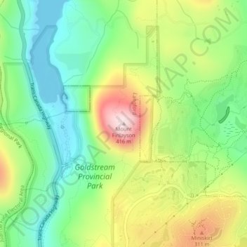
Name: Mount Finlayson topographic map, elevation, terrain.
Average elevation: 158 m
Minimum elevation: 0 m
Maximum elevation: 408 m
Thank you for supporting this site ❤️
Make a donation
Make a donation
Other topographic maps
Click on a map to view its topography, its elevation and its terrain.
Florence Lake
Canada > British Columbia > Capital Regional District > Langford
Average elevation: 121 m
Goldstream Provincial Park
Canada > British Columbia > Capital Regional District > Langford
Average elevation: 178 m
Langford Lake
Canada > British Columbia > Capital Regional District > Langford
Average elevation: 105 m
Florence Lake
Canada > British Columbia > Capital Regional District > Langford
Average elevation: 121 m
Thank you for supporting this site ❤️
Make a donation
Make a donation