
Thank you for supporting this site ❤️
Make a donation
Make a donation
Standart topographic map
Click on the map to display elevation.
Thank you for supporting this site ❤️
Make a donation
Make a donation
About this map
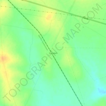
Name: Standart topographic map, elevation, terrain.
Location: Standart, Kinney County, Texas, United States (29.32245 -100.63814 29.36245 -100.59814)
Average elevation: 331 m
Minimum elevation: 317 m
Maximum elevation: 345 m
Thank you for supporting this site ❤️
Make a donation
Make a donation
Other topographic maps
Click on a map to view its topography, its elevation and its terrain.