
Thank you for supporting this site ❤️
Make a donation
Make a donation
Mount Pleasant topographic map
Click on the map to display elevation.
Thank you for supporting this site ❤️
Make a donation
Make a donation
About this map
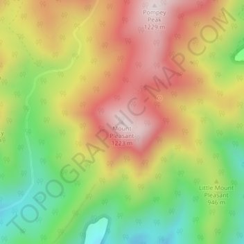
Name: Mount Pleasant topographic map, elevation, terrain.
Location: Mount Pleasant, Amherst County, Virginia, United States (37.74087 -79.17132 37.74097 -79.17122)
Average elevation: 954 m
Minimum elevation: 673 m
Maximum elevation: 1,226 m
Thank you for supporting this site ❤️
Make a donation
Make a donation