
Thank you for supporting this site ❤️
Make a donation
Make a donation
Lwabikere topographic map
Click on the map to display elevation.
Thank you for supporting this site ❤️
Make a donation
Make a donation
About this map
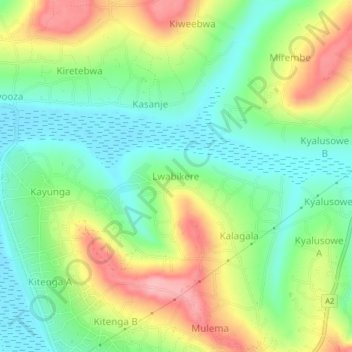
Name: Lwabikere topographic map, elevation, terrain.
Location: Lwabikere, Masaka City, Uganda (-0.30045 31.74594 -0.26045 31.78594)
Average elevation: 1,241 m
Minimum elevation: 1,187 m
Maximum elevation: 1,323 m
Thank you for supporting this site ❤️
Make a donation
Make a donation