
Thank you for supporting this site ❤️
Make a donation
Make a donation
Ufuma topographic map
Click on the map to display elevation.
Thank you for supporting this site ❤️
Make a donation
Make a donation
About this map
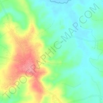
Name: Ufuma topographic map, elevation, terrain.
Location: Ufuma, Orumba North, Anambra State, Nigeria (6.06479 7.18294 6.10479 7.22294)
Average elevation: 92 m
Minimum elevation: 54 m
Maximum elevation: 159 m
Thank you for supporting this site ❤️
Make a donation
Make a donation