
Thank you for supporting this site ❤️
Make a donation
Make a donation
Methuen Lake topographic map
Click on the map to display elevation.
Thank you for supporting this site ❤️
Make a donation
Make a donation
About this map
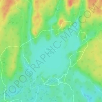
Name: Methuen Lake topographic map, elevation, terrain.
Average elevation: 293 m
Minimum elevation: 276 m
Maximum elevation: 319 m
Thank you for supporting this site ❤️
Make a donation
Make a donation
Other topographic maps
Click on a map to view its topography, its elevation and its terrain.
Cordova Mines
Canada > Ontario > Peterborough County > Havelock-Belmont-Methuen
Average elevation: 209 m