
Thank you for supporting this site ❤️
Make a donation
Make a donation
Oak Harbor topographic map
Click on the map to display elevation.
Thank you for supporting this site ❤️
Make a donation
Make a donation
About this map
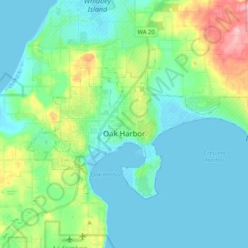
Name: Oak Harbor topographic map, elevation, terrain.
Location: Oak Harbor, Island County, Washington, United States (48.26763 -122.70024 48.32569 -122.55588)
Average elevation: 31 m
Minimum elevation: -2 m
Maximum elevation: 142 m
Thank you for supporting this site ❤️
Make a donation
Make a donation
Other topographic maps
Click on a map to view its topography, its elevation and its terrain.