
Thank you for supporting this site ❤️
Make a donation
Make a donation
Pleasant Hill topographic map
Click on the map to display elevation.
Thank you for supporting this site ❤️
Make a donation
Make a donation
About this map
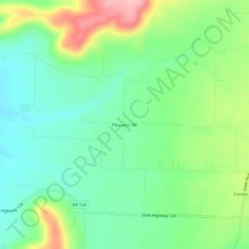
Name: Pleasant Hill topographic map, elevation, terrain.
Location: Pleasant Hill, Conway County, Arkansas, 72027, United States (35.36508 -92.60710 35.40508 -92.56710)
Average elevation: 212 m
Minimum elevation: 159 m
Maximum elevation: 317 m
Thank you for supporting this site ❤️
Make a donation
Make a donation
Other topographic maps
Click on a map to view its topography, its elevation and its terrain.