
Thank you for supporting this site ❤️
Make a donation
Make a donation
Beveringen topographic map
Click on the map to display elevation.
Thank you for supporting this site ❤️
Make a donation
Make a donation
About this map
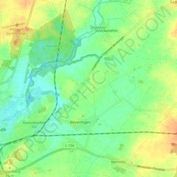
Name: Beveringen topographic map, elevation, terrain.
Location: Beveringen, Pritzwalk, Prignitz, Brandenburg, Deutschland (53.13520 12.19022 53.18747 12.26053)
Average elevation: 75 m
Minimum elevation: 60 m
Maximum elevation: 95 m
Thank you for supporting this site ❤️
Make a donation
Make a donation
Other topographic maps
Click on a map to view its topography, its elevation and its terrain.