
Thank you for supporting this site ❤️
Make a donation
Make a donation
Kalix kommun topographic map
Click on the map to display elevation.
Thank you for supporting this site ❤️
Make a donation
Make a donation
About this map
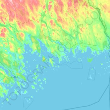
Name: Kalix kommun topographic map, elevation, terrain.
Location: Kalix kommun, Norrbotten County, Sweden (65.28976 22.33804 66.23880 23.85918)
Average elevation: 33 m
Minimum elevation: -3 m
Maximum elevation: 302 m
Thank you for supporting this site ❤️
Make a donation
Make a donation
Other topographic maps
Click on a map to view its topography, its elevation and its terrain.