
Commune Caracol topographic map
Interactive map
Click on the map to display elevation.
About this map
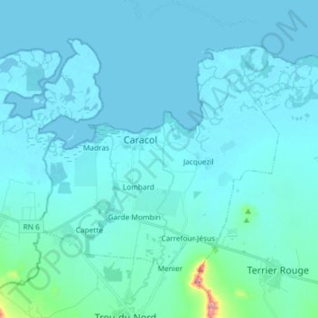
Name: Commune Caracol topographic map, elevation, terrain.
Average elevation: 16 m
Minimum elevation: -1 m
Maximum elevation: 227 m
Other topographic maps
Click on a map to view its topography, its elevation and its terrain.
Volant
Haïti > Département du Nord-Est > Commune Caracol > Bas-Carrefour > Volant
Volant, 2e Claudine, Bas-Carrefour, Commune Caracol, Arrondissement Trou-Du-Nord, Département du Nord-Est, Haïti
Average elevation: 22 m