
Thank you for supporting this site ❤️
Make a donation
Make a donation
Bodendorf topographic map
Click on the map to display elevation.
Thank you for supporting this site ❤️
Make a donation
Make a donation
About this map
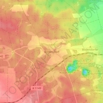
Name: Bodendorf topographic map, elevation, terrain.
Location: Bodendorf, Haldensleben, Börde, Sachsen-Anhalt, Deutschland (52.26565 11.26972 52.30565 11.30972)
Average elevation: 120 m
Minimum elevation: 60 m
Maximum elevation: 148 m
Thank you for supporting this site ❤️
Make a donation
Make a donation
Other topographic maps
Click on a map to view its topography, its elevation and its terrain.
Süplingen
Deutschland > Sachsen-Anhalt > Börde > Haldensleben
Die Süplingen liegt etwa fünf Kilometer westlich der Innenstadt von Haldensleben im Flechtinger Höhenzug. Zu Süplingen gehört auch der Ortsteil Bodendorf.
Average elevation: 102 m
Thank you for supporting this site ❤️
Make a donation
Make a donation