
Thank you for supporting this site ❤️
Make a donation
Make a donation
Kitsap County topographic map
Click on the map to display elevation.
Thank you for supporting this site ❤️
Make a donation
Make a donation
About this map
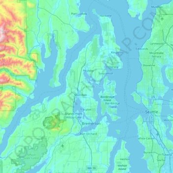
Name: Kitsap County topographic map, elevation, terrain.
Location: Kitsap County, Washington, United States (47.40254 -123.03215 47.96958 -122.43200)
Average elevation: 138 m
Minimum elevation: -4 m
Maximum elevation: 1,884 m
Thank you for supporting this site ❤️
Make a donation
Make a donation