
Naranjal topographic map
Interactive map
Click on the map to display elevation.
About this map
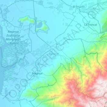
Name: Naranjal topographic map, elevation, terrain.
Location: Naranjal, Guayas, Ecuador (-2.84926 -79.80550 -2.29710 -79.36726)
Average elevation: 596 m
Minimum elevation: -4 m
Maximum elevation: 4,508 m