
Fa topographic map
Interactive map
Click on the map to display elevation.
About this map
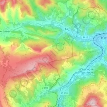
Name: Fa topographic map, elevation, terrain.
Average elevation: 385 m
Minimum elevation: 238 m
Maximum elevation: 605 m
Other topographic maps
Click on a map to view its topography, its elevation and its terrain.
Rouvenac
France > Occitanie > Aude > Val-du-Faby
Rouvenac, Val-du-Faby, Limoux, Aude, Occitanie, France métropolitaine, 11260, France
Average elevation: 437 m