
Thank you for supporting this site ❤️
Make a donation
Make a donation
Marienthal topographic map
Click on the map to display elevation.
Thank you for supporting this site ❤️
Make a donation
Make a donation
Marienthal
Der Weinort Marienthal besitzt fünf Einzellagen. Es handelt sich durchweg um Steillagen mit Grauwackeverwitterungen im oberen Bereich und Löß und Lehm im unteren Abschnitt. Die erzeugten Weine fallen von den Trauben im oberen Bereich (um 200–250 m Höhe) fruchtig und von den Rebstöcken im unteren Abschnitt (um 100 m) füllig-kräftiger aus.
Thank you for supporting this site ❤️
Make a donation
Make a donation
About this map
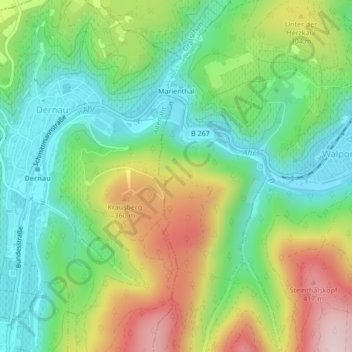
Name: Marienthal topographic map, elevation, terrain.
Average elevation: 232 m
Minimum elevation: 108 m
Maximum elevation: 441 m
Thank you for supporting this site ❤️
Make a donation
Make a donation