
Thank you for supporting this site ❤️
Make a donation
Make a donation
Dyer topographic map
Click on the map to display elevation.
Thank you for supporting this site ❤️
Make a donation
Make a donation
About this map
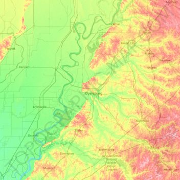
Name: Dyer topographic map, elevation, terrain.
Location: Dyer, Tennessee, 38024, United States (35.35433 -90.12082 36.75433 -88.72082)
Average elevation: 100 m
Minimum elevation: 58 m
Maximum elevation: 195 m
Thank you for supporting this site ❤️
Make a donation
Make a donation