
Thank you for supporting this site ❤️
Make a donation
Make a donation
Timrå District topographic map
Click on the map to display elevation.
Thank you for supporting this site ❤️
Make a donation
Make a donation
About this map
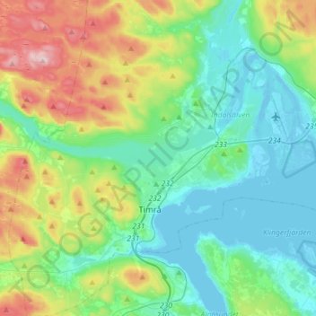
Name: Timrå District topographic map, elevation, terrain.
Location: Timrå District, Timrå kommun, Västernorrland County, Sweden (62.44459 17.20036 62.57601 17.46101)
Average elevation: 81 m
Minimum elevation: -3 m
Maximum elevation: 309 m
Thank you for supporting this site ❤️
Make a donation
Make a donation
Other topographic maps
Click on a map to view its topography, its elevation and its terrain.