
Thank you for supporting this site ❤️
Make a donation
Make a donation
Pardue Mill topographic map
Click on the map to display elevation.
Thank you for supporting this site ❤️
Make a donation
Make a donation
About this map
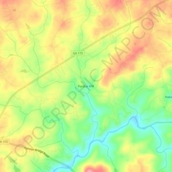
Name: Pardue Mill topographic map, elevation, terrain.
Location: Pardue Mill, Habersham County, Georgia, 30544, United States (34.57232 -83.60517 34.61232 -83.56517)
Average elevation: 413 m
Minimum elevation: 358 m
Maximum elevation: 464 m
Thank you for supporting this site ❤️
Make a donation
Make a donation
Other topographic maps
Click on a map to view its topography, its elevation and its terrain.
Thank you for supporting this site ❤️
Make a donation
Make a donation
Thank you for supporting this site ❤️
Make a donation
Make a donation