
Thank you for supporting this site ❤️
Make a donation
Make a donation
Blankenburg (Harz) topographic map
Click on the map to display elevation.
Thank you for supporting this site ❤️
Make a donation
Make a donation
Blankenburg (Harz)
Die Stadt Blankenburg (Harz) liegt dicht am Nordrand des Harzes in etwa 234 m Höhe. Blankenburg (Harz) befindet sich westlich von Quedlinburg, südlich von Halberstadt und östlich von Wernigerode. Der Goldbach fließt durch den nordwestlich des Stadtzentrums gelegenen Stadtteil Oesig.
Thank you for supporting this site ❤️
Make a donation
Make a donation
About this map
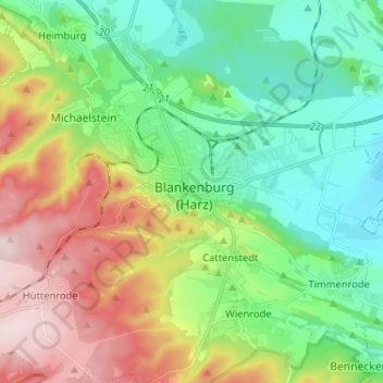
Name: Blankenburg (Harz) topographic map, elevation, terrain.
Average elevation: 272 m
Minimum elevation: 148 m
Maximum elevation: 500 m
Thank you for supporting this site ❤️
Make a donation
Make a donation