
Thank you for supporting this site ❤️
Make a donation
Make a donation
Clark topographic map
Click on the map to display elevation.
Thank you for supporting this site ❤️
Make a donation
Make a donation
About this map
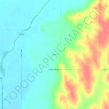
Name: Clark topographic map, elevation, terrain.
Location: Clark, Mills County, Iowa, United States (40.93055 -95.56028 40.97055 -95.52028)
Average elevation: 314 m
Minimum elevation: 293 m
Maximum elevation: 356 m
Thank you for supporting this site ❤️
Make a donation
Make a donation
Other topographic maps
Click on a map to view its topography, its elevation and its terrain.