
Thank you for supporting this site ❤️
Make a donation
Make a donation
Auesee topographic map
Click on the map to display elevation.
Thank you for supporting this site ❤️
Make a donation
Make a donation
About this map
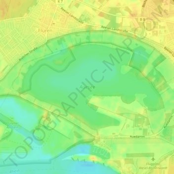
Name: Auesee topographic map, elevation, terrain.
Location: Auesee, Wesel, Kreis Wesel, Nordrhein-Westfalen, Deutschland (51.66574 6.56760 51.67884 6.60185)
Average elevation: 20 m
Minimum elevation: 6 m
Maximum elevation: 30 m
Thank you for supporting this site ❤️
Make a donation
Make a donation
Other topographic maps
Click on a map to view its topography, its elevation and its terrain.