
Stockwood topographic map
Click on the map to display elevation.
About this map
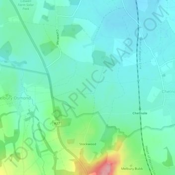
Name: Stockwood topographic map, elevation, terrain.
Location: Stockwood, Dorset, England, DT2 0NG, United Kingdom (50.85543 -2.59821 50.88429 -2.57569)
Average elevation: 86 m
Minimum elevation: 54 m
Maximum elevation: 193 m
Other topographic maps
Click on a map to view its topography, its elevation and its terrain.
River Frome
United Kingdom > England > Dorset > Maiden Newton > Frome Vauchurch
Average elevation: 132 m