
Pātea Dam topographic map
Interactive map
Click on the map to display elevation.
About this map
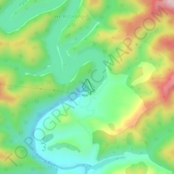
Name: Pātea Dam topographic map, elevation, terrain.
Location: Pātea Dam, South Taranaki District, Taranaki, New Zealand (-39.54687 174.56724 -39.54450 174.56966)
Average elevation: 128 m
Minimum elevation: 16 m
Maximum elevation: 327 m
Other topographic maps
Click on a map to view its topography, its elevation and its terrain.
Eltham
New Zealand > Taranaki > South Taranaki District
Eltham, South Taranaki District, Taranaki, 4322, New Zealand
Average elevation: 223 m
Hawera
New Zealand > Taranaki > South Taranaki District
Hawera, South Taranaki District, Taranaki, 4610, New Zealand
Average elevation: 79 m
Kaponga
New Zealand > Taranaki > South Taranaki District
Kaponga, South Taranaki District, Taranaki, 4697, New Zealand
Average elevation: 272 m