
Gemeinde Årjäng topographic map
Interactive map
Click on the map to display elevation.
About this map
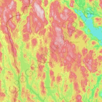
Name: Gemeinde Årjäng topographic map, elevation, terrain.
Location: Gemeinde Årjäng, Provinz Värmland, Schweden (59.17358 11.69113 59.72816 12.51233)
Average elevation: 168 m
Minimum elevation: 42 m
Maximum elevation: 340 m
Other topographic maps
Click on a map to view its topography, its elevation and its terrain.
Hagfors kommun
Hagfors kommun, Provinz Värmland, Schweden
Average elevation: 257 m
Sunne kommun
Sunne kommun, Provinz Värmland, Schweden
Average elevation: 194 m
Knon
Knon, Hagfors kommun, Provinz Värmland, Schweden
Average elevation: 281 m