
Ekiti East topographic map
Interactive map
Click on the map to display elevation.
About this map
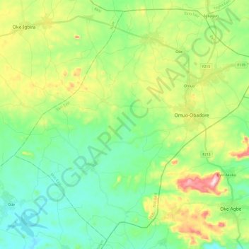
Name: Ekiti East topographic map, elevation, terrain.
Location: Ekiti East, Ekiti State, Nigeria (7.61206 5.55465 7.83009 5.79162)
Average elevation: 501 m
Minimum elevation: 375 m
Maximum elevation: 786 m
Other topographic maps
Click on a map to view its topography, its elevation and its terrain.