Geolocate
👉 Easily get elevation data in JSON, GeoTIFF and KML formats using Elevation API
Thank you for supporting this site ❤️
Make a donation

Patani topographic map

Click on the map to display elevation.

👉 Easily get elevation data in JSON, GeoTIFF and KML formats using Elevation API
Thank you for supporting this site ❤️
Make a donation

About this map

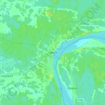
Name: Patani topographic map, elevation, terrain.

Location: Patani, Delta State, Nigeria (5.18813 6.15216 5.26813 6.23216)

Average elevation: 9 m

Minimum elevation: 3 m

Maximum elevation: 17 m