
Thank you for supporting this site ❤️
Make a donation
Make a donation
Münchhausen topographic map
Click on the map to display elevation.
Thank you for supporting this site ❤️
Make a donation
Make a donation
About this map
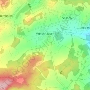
Name: Münchhausen topographic map, elevation, terrain.
Location: Münchhausen, Driedorf, Lahn-Dill-Kreis, Hessen, Deutschland (50.59872 8.14888 50.62704 8.20989)
Average elevation: 498 m
Minimum elevation: 421 m
Maximum elevation: 610 m
Thank you for supporting this site ❤️
Make a donation
Make a donation