
Thank you for supporting this site ❤️
Make a donation
Make a donation
Marbeck topographic map
Click on the map to display elevation.
Thank you for supporting this site ❤️
Make a donation
Make a donation
About this map
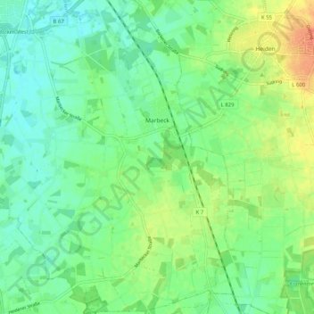
Name: Marbeck topographic map, elevation, terrain.
Location: Marbeck, Borken, Kreis Borken, Nordrhein-Westfalen, Deutschland (51.77373 6.84458 51.83613 6.92362)
Average elevation: 61 m
Minimum elevation: 46 m
Maximum elevation: 86 m
Thank you for supporting this site ❤️
Make a donation
Make a donation