
Siddamulla topographic map
Interactive map
Click on the map to display elevation.
About this map
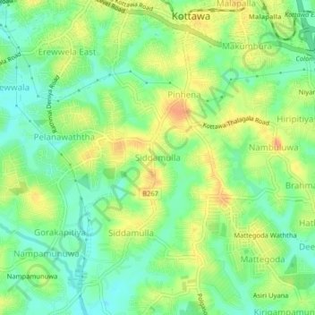
Name: Siddamulla topographic map, elevation, terrain.
Location: Siddamulla, Colombo District, Western Province, 10230, Sri Lanka (6.80504 79.94127 6.84504 79.98127)
Average elevation: 22 m
Minimum elevation: 4 m
Maximum elevation: 43 m
Other topographic maps
Click on a map to view its topography, its elevation and its terrain.
Yagirala
Sri Lanka > Western Province > Walallawita DS Division
Yagirala, Walallawita DS Division, Kalutara District, Western Province, Sri Lanka
Average elevation: 66 m
Sri Jayawardenapura Kotte
Sri Lanka > Western Province > Sri Jayawardenapura Kotte
Sri Jayawardenapura Kotte, Colombo District, Western Province, KOTTE, Sri Lanka
Average elevation: 12 m
Cinnamon Gardens
Sri Lanka > Western Province > Colombo
Cinnamon Gardens, Colombo, Colombo District, Western Province, Sri Lanka
Average elevation: 12 m