
Thank you for supporting this site ❤️
Make a donation
Make a donation
Theodosia topographic map
Click on the map to display elevation.
Thank you for supporting this site ❤️
Make a donation
Make a donation
About this map
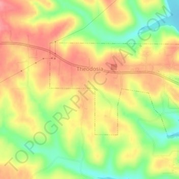
Name: Theodosia topographic map, elevation, terrain.
Location: Theodosia, Ozark County, Missouri, United States (36.57178 -92.68415 36.58706 -92.64786)
Average elevation: 249 m
Minimum elevation: 197 m
Maximum elevation: 288 m
Thank you for supporting this site ❤️
Make a donation
Make a donation
Other topographic maps
Click on a map to view its topography, its elevation and its terrain.