
Make a donation
Placida topographic map
Click on the map to display elevation.
Make a donation
Placida
Placida is located at 26°49′55″N 82°15′54″W / 26.83194°N 82.265°W / 26.83194; -82.265 (26.83194, -82.265). Placida has an elevation of 3 feet.
Make a donation
About this map
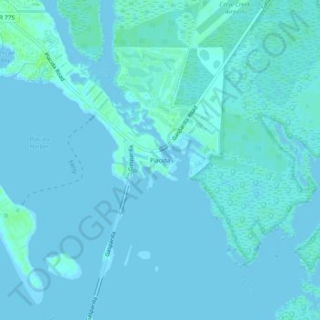
Name: Placida topographic map, elevation, terrain.
Location: Placida, Charlotte County, Florida, 33946, United States (26.81229 -82.28482 26.85229 -82.24482)
Average elevation: 1 m
Minimum elevation: -2 m
Maximum elevation: 8 m
Make a donation
Other topographic maps
Click on a map to view its topography, its elevation and its terrain.
Gilcrest Park
United States > Florida > Charlotte County > Punta Gorda > Fishermens Village
Average elevation: 2 m
Ainger Creek Park
United States > Florida > Charlotte County > Englewood > New Point Comfort
Average elevation: 3 m
Make a donation
Harbour Heights
United States > Florida > Charlotte County > Punta Gorda > Harbour Heights
Average elevation: 4 m