
Le Pest topographic map
Interactive map
Click on the map to display elevation.
About this map
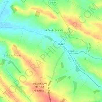
Name: Le Pest topographic map, elevation, terrain.
Average elevation: 162 m
Minimum elevation: 131 m
Maximum elevation: 200 m
Other topographic maps
Click on a map to view its topography, its elevation and its terrain.
Le Pest
France > Occitanie > Sainte-Anne
Le Pest, Sainte-Anne, Condom, Gers, Occitanie, France métropolitaine, 32430, France
Average elevation: 154 m