
Thank you for supporting this site ❤️
Make a donation
Make a donation
Bois d'Olives topographic map
Click on the map to display elevation.
Thank you for supporting this site ❤️
Make a donation
Make a donation
About this map
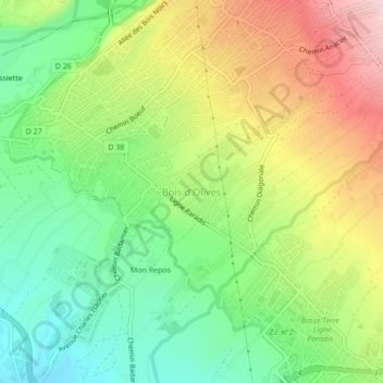
Name: Bois d'Olives topographic map, elevation, terrain.
Location: Bois d'Olives, Saint-Pierre, La Réunion, 97432, France (-21.32415 55.44458 -21.28415 55.48458)
Average elevation: 142 m
Minimum elevation: 13 m
Maximum elevation: 322 m
Thank you for supporting this site ❤️
Make a donation
Make a donation
Other topographic maps
Click on a map to view its topography, its elevation and its terrain.