
Arata topographic map
Interactive map
Click on the map to display elevation.
About this map
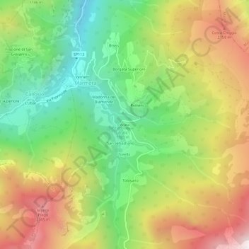
Name: Arata topographic map, elevation, terrain.
Location: Arata, Cuneo, Piemont, Italien (44.43088 7.08300 44.47088 7.12300)
Average elevation: 1,698 m
Minimum elevation: 1,074 m
Maximum elevation: 2,490 m
Other topographic maps
Click on a map to view its topography, its elevation and its terrain.