
Thank you for supporting this site ❤️
Make a donation
Make a donation
Strong City topographic map
Click on the map to display elevation.
Thank you for supporting this site ❤️
Make a donation
Make a donation
About this map
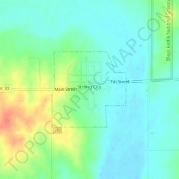
Name: Strong City topographic map, elevation, terrain.
Location: Strong City, Roger Mills County, Oklahoma, United States (35.66418 -99.60647 35.67557 -99.59273)
Average elevation: 576 m
Minimum elevation: 560 m
Maximum elevation: 612 m
Thank you for supporting this site ❤️
Make a donation
Make a donation
Other topographic maps
Click on a map to view its topography, its elevation and its terrain.