
Thank you for supporting this site ❤️
Make a donation
Make a donation
Barnes Mill topographic map
Click on the map to display elevation.
Thank you for supporting this site ❤️
Make a donation
Make a donation
About this map
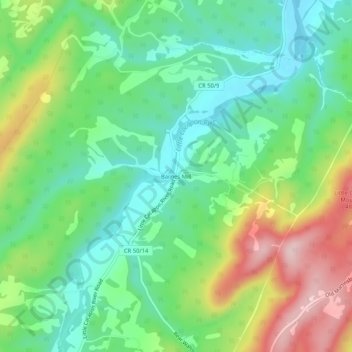
Name: Barnes Mill topographic map, elevation, terrain.
Location: Barnes Mill, Hampshire County, West Virginia, United States (39.33121 -78.65640 39.37121 -78.61640)
Average elevation: 351 m
Minimum elevation: 261 m
Maximum elevation: 519 m
Thank you for supporting this site ❤️
Make a donation
Make a donation
Other topographic maps
Click on a map to view its topography, its elevation and its terrain.