
Thank you for supporting this site ❤️
Make a donation
Make a donation
Uitikon topographic map
Click on the map to display elevation.
Thank you for supporting this site ❤️
Make a donation
Make a donation
About this map
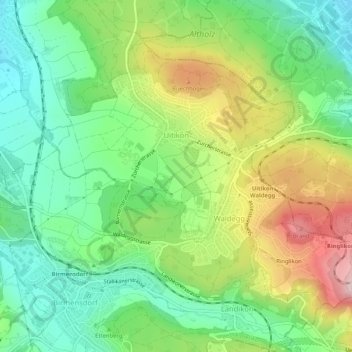
Name: Uitikon topographic map, elevation, terrain.
Location: Uitikon, Bezirk Dietikon, Zurich, 8142, Switzerland (47.35268 8.43541 47.38025 8.48729)
Average elevation: 542 m
Minimum elevation: 429 m
Maximum elevation: 731 m
Thank you for supporting this site ❤️
Make a donation
Make a donation
Other topographic maps
Click on a map to view its topography, its elevation and its terrain.