
Make a donation
Slingerlands topographic map
Click on the map to display elevation.
Make a donation
About this map
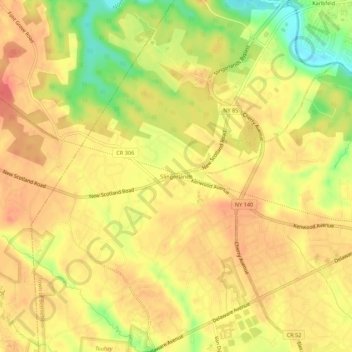
Name: Slingerlands topographic map, elevation, terrain.
Average elevation: 65 m
Minimum elevation: 28 m
Maximum elevation: 84 m
Make a donation
Other topographic maps
Click on a map to view its topography, its elevation and its terrain.
City of Albany
United States > New York > Albany County
The highest natural point in Albany is a USGS benchmark near the Loudonville Reservoir off Birch Hill Road, at 378 feet (115 m) above sea level. The lowest point is sea level at the Hudson River (the average water elevation is 2 feet (0.61 m)), which is still technically an estuary at Albany and is affected by…
Average elevation: 68 m
Village of Green Island
United States > New York > Albany County > Town of Colonie
Average elevation: 19 m
City of Albany
United States > New York > Albany County
The highest natural point in Albany is a USGS benchmark near the Loudonville Reservoir off Birch Hill Road, at 378 feet (115 m) above sea level. The lowest point is sea level at the Hudson River (the average water elevation is 2 feet (0.61 m)), which is still technically an estuary at Albany and is affected by…
Average elevation: 68 m
Make a donation
Village of Voorheesville
United States > New York > Albany County > Town of New Scotland
Average elevation: 107 m
Siena College
United States > New York > Albany County > Town of Colonie > Newtonville
Average elevation: 98 m
Make a donation
Make a donation
Make a donation
Make a donation
Make a donation
Preston-Potter Hollow
United States > New York > Albany County > Town of Rensselaerville
It is also the topographical location of Potter Hollow.
Average elevation: 371 m
Make a donation
Make a donation
Make a donation
Village of Altamont
United States > New York > Albany County > Town of Guilderland
Average elevation: 158 m
Medusa
United States > New York > Albany County
Medusa is located at 42°26′12″N 074°07′48″W / 42.43667°N 74.13000°W / 42.43667; -74.13000 (42.4367469, -74.1301365) and its elevation is 804 feet (245 m).
Average elevation: 297 m
City of Albany
United States > New York > Albany County
The highest natural point in Albany is a USGS benchmark near the Loudonville Reservoir off Birch Hill Road, at 378 feet (115 m) above sea level. The lowest point is sea level at the Hudson River (the average water elevation is 2 feet (0.61 m)), which is still technically an estuary at Albany and is affected by…
Average elevation: 68 m
Make a donation