
高而办事处 topographic map
Interactive map
Click on the map to display elevation.
About this map
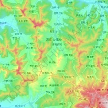
Name: 高而办事处 topographic map, elevation, terrain.
Location: 高而办事处, 仲宫街道, 南部山区, 历城区, 济南市, 山东省, 250100, 中国 (36.33044 117.00453 36.44911 117.08346)
Average elevation: 370 m
Minimum elevation: 151 m
Maximum elevation: 840 m
Other topographic maps
Click on a map to view its topography, its elevation and its terrain.