
Thank you for supporting this site ❤️
Make a donation
Make a donation
Union topographic map
Click on the map to display elevation.
Thank you for supporting this site ❤️
Make a donation
Make a donation
About this map
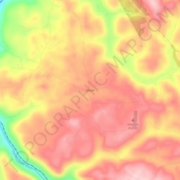
Name: Union topographic map, elevation, terrain.
Location: Union, Barbour County, West Virginia, United States (39.08010 -80.05814 39.12010 -80.01814)
Average elevation: 545 m
Minimum elevation: 400 m
Maximum elevation: 619 m
Thank you for supporting this site ❤️
Make a donation
Make a donation
Other topographic maps
Click on a map to view its topography, its elevation and its terrain.